
A'Thuraya City
A new city emerging from the landscape, where the logic of the land shapes urban life.




- Project and location
- A'Thuraya City, Muscat, Oman
- Year
- 2025
- Typology
- Masterplanning & Urbanism
A Constellation of Villages
A’Thuraya City is conceived as an urban framework where Oman’s future ambitions meet the intelligence of its landscape. The masterplan brings together eight distinct settlements, each shaped by its relationship to terrain, water, access and climate. Different densities, movement systems and forms of habitation give each settlement its own character, while shared ecological and mobility networks connect the wider city. Landscape becomes the project’s primary design system, allowing urbanity, ecology and identity to evolve together as a grounded yet forward-looking constellation of places rooted in Oman’s identity.
- Project and location
- A'Thuraya City, Muscat, Oman
- Year
- 2025
- Typology
- Masterplanning & Urbanism

The project begins by reading the land.
Topography, water movement and habitat define what is retained, connected and inhabited.
- Project and location
- A'Thuraya City, Muscat, Oman
- Year
- 2025
- Typology
- Masterplanning & Urbanism
01. Wadi Village
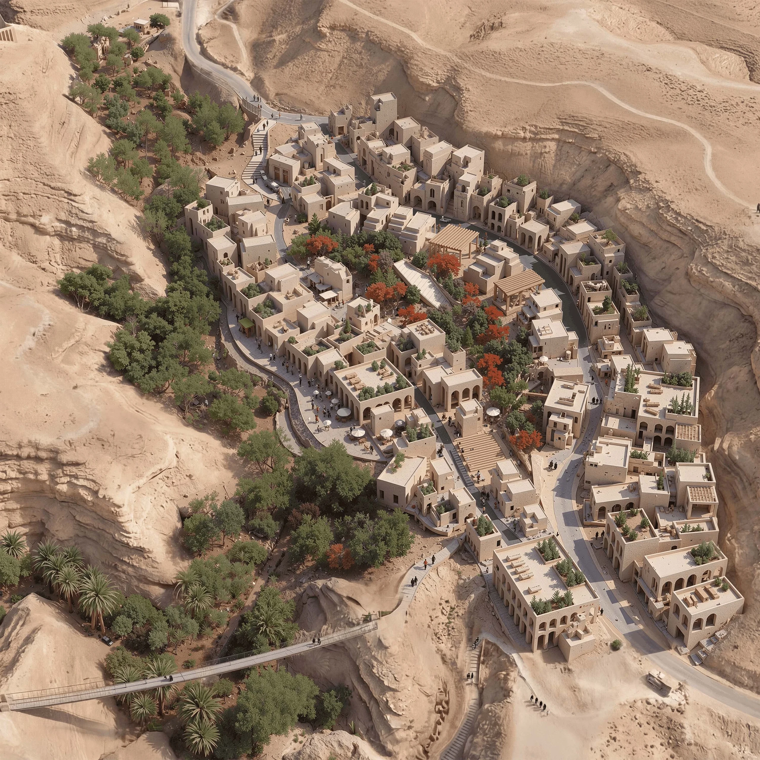
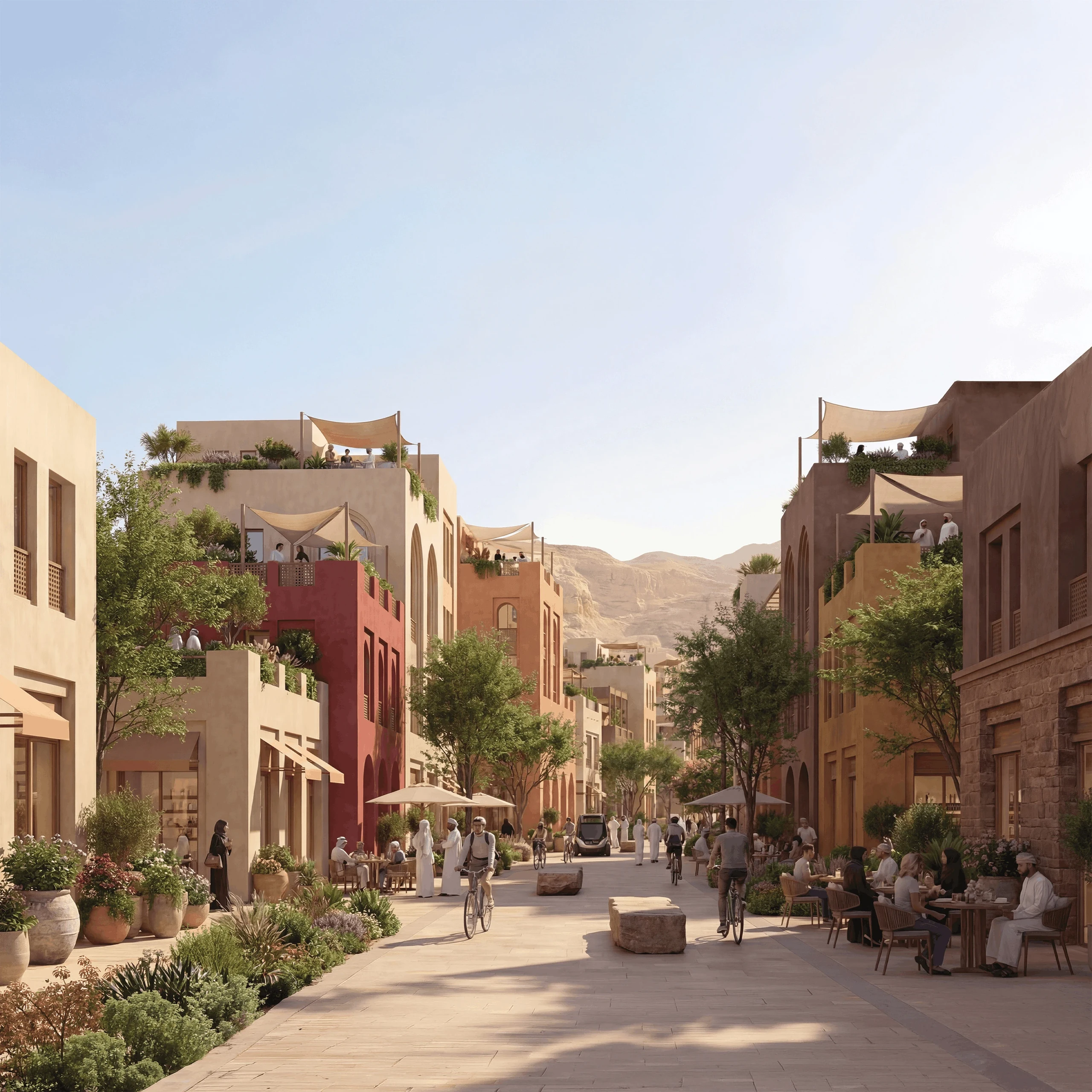
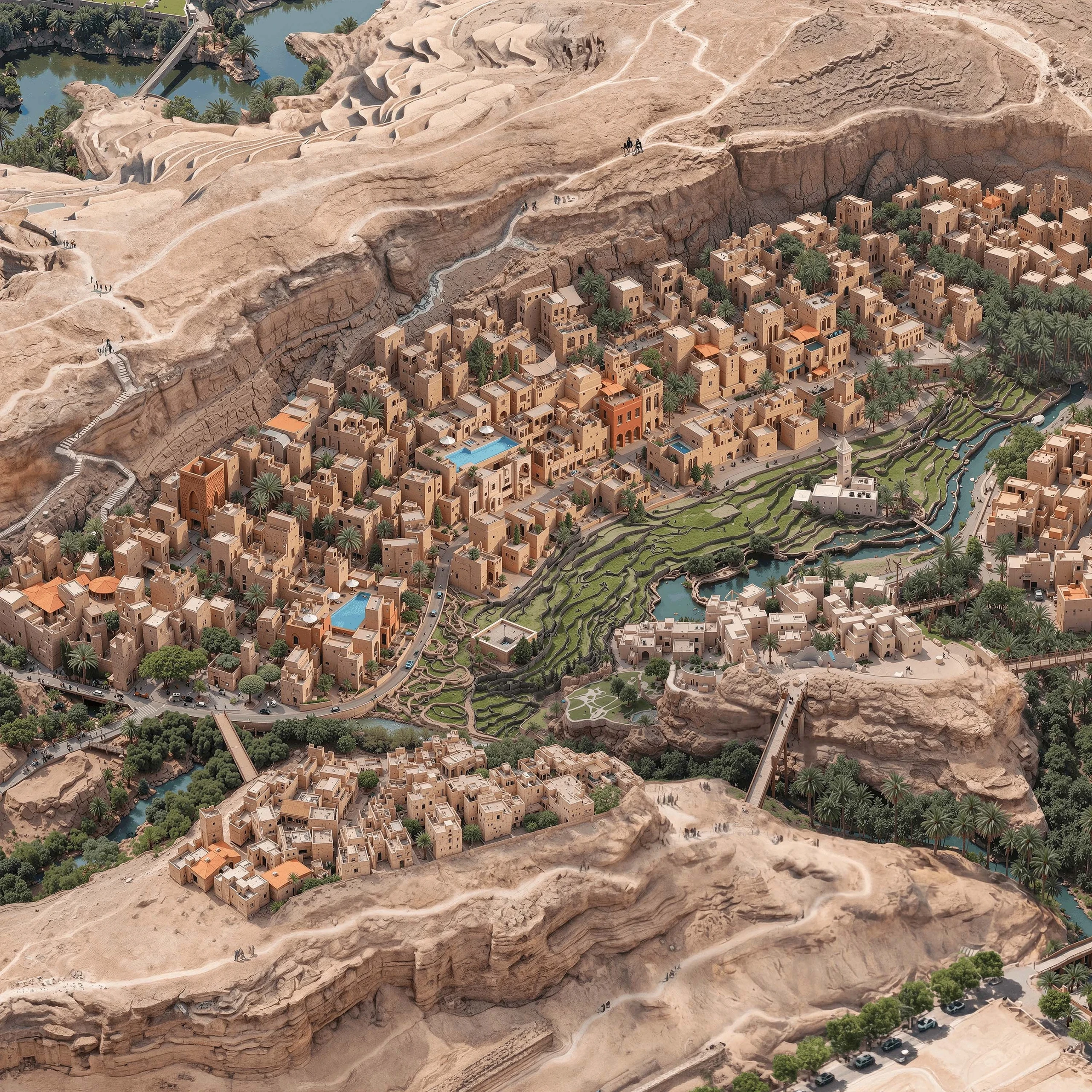
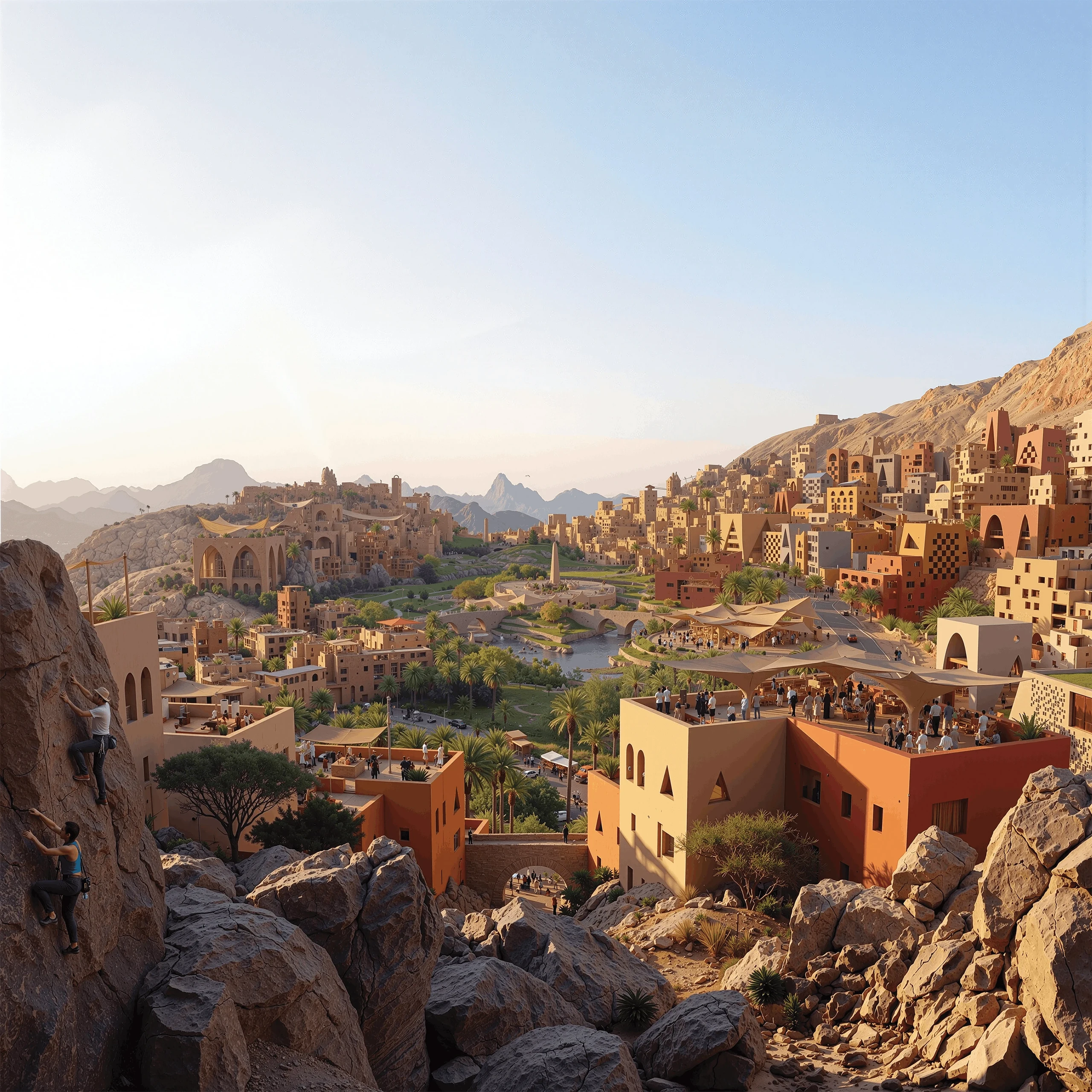
Wadi Village occupies lower terrain where water, shade and cultivation can support compact settlement. Homes cluster along pedestrian streets and terraces, with productive landscapes and water channels integrated into the public realm. The wadi becomes an organising corridor for movement, climate and community.
- Project and location
- A'Thuraya City, Muscat, Oman
- Year
- 2025
- Typology
- Masterplanning & Urbanism
02. Farm City
Farm City integrates housing with productive landscape rather than separating agriculture at the urban edge. Residential clusters are organised around cultivated plots, water infrastructure and shared community facilities, allowing food production, daily movement and public life to operate within one district.
- Project and location
- A'Thuraya City, Muscat, Oman
- Year
- 2025
- Typology
- Masterplanning & Urbanism
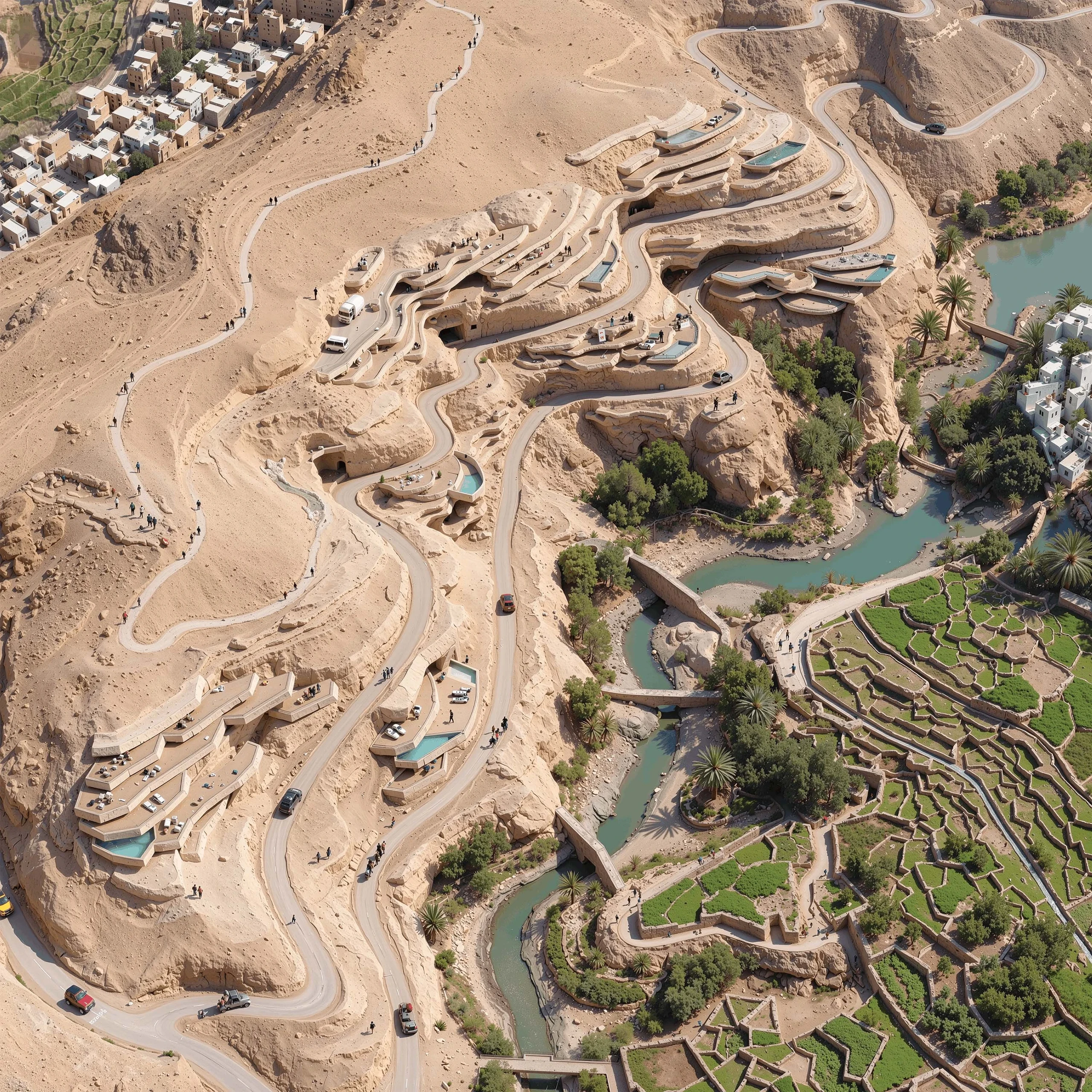
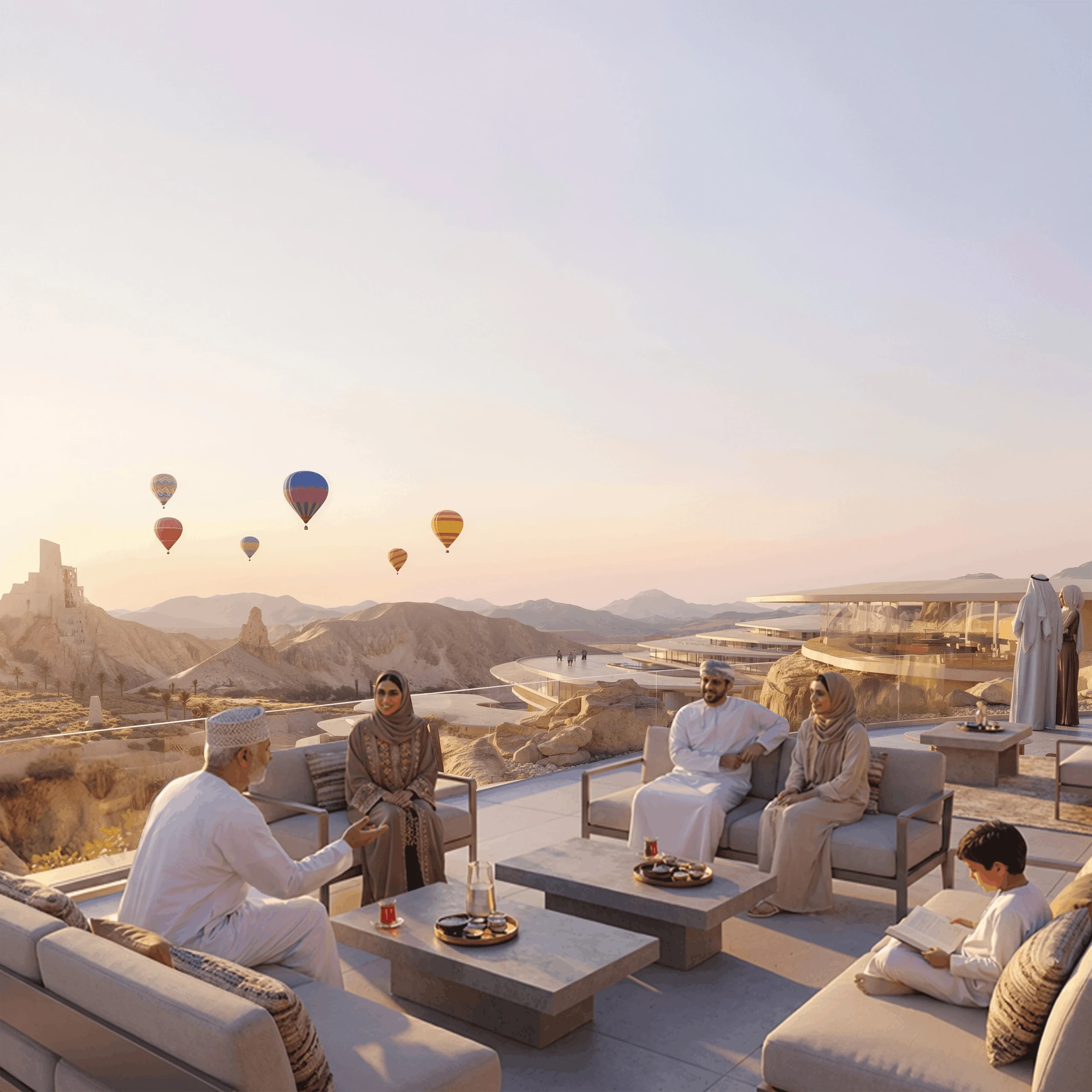
03. Plateau Villas
Plateau Villas are distributed along higher, more stable ground, using stepped plots and low building profiles to retain long views and reduce visual exposure. Roads and terraces follow the contours, allowing the residential fabric to adapt to the slope while limiting unnecessary cut and fill.
- Project and location
- A'Thuraya City, Muscat, Oman
- Year
- 2025
- Typology
- Masterplanning & Urbanism
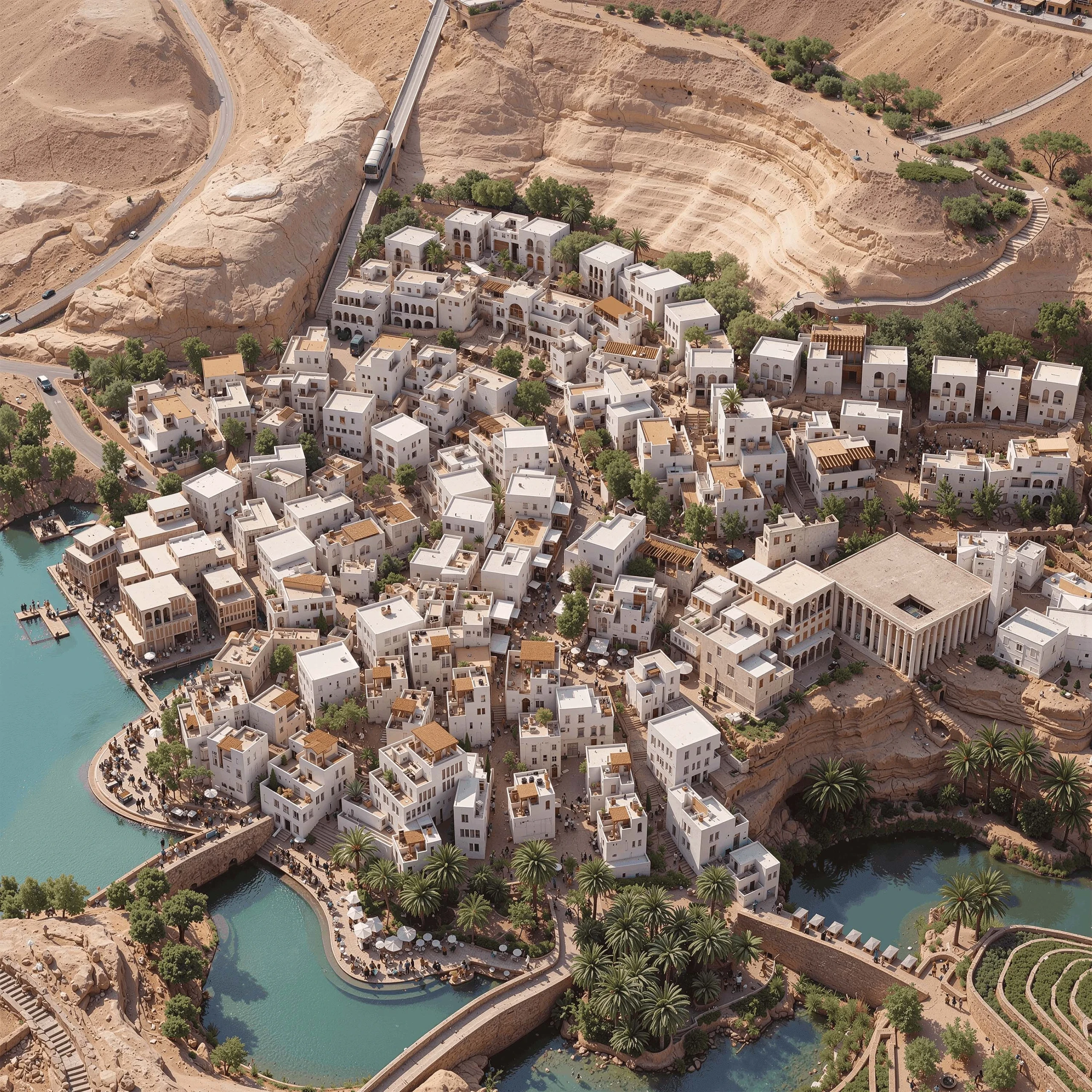
04. Lakeside Village
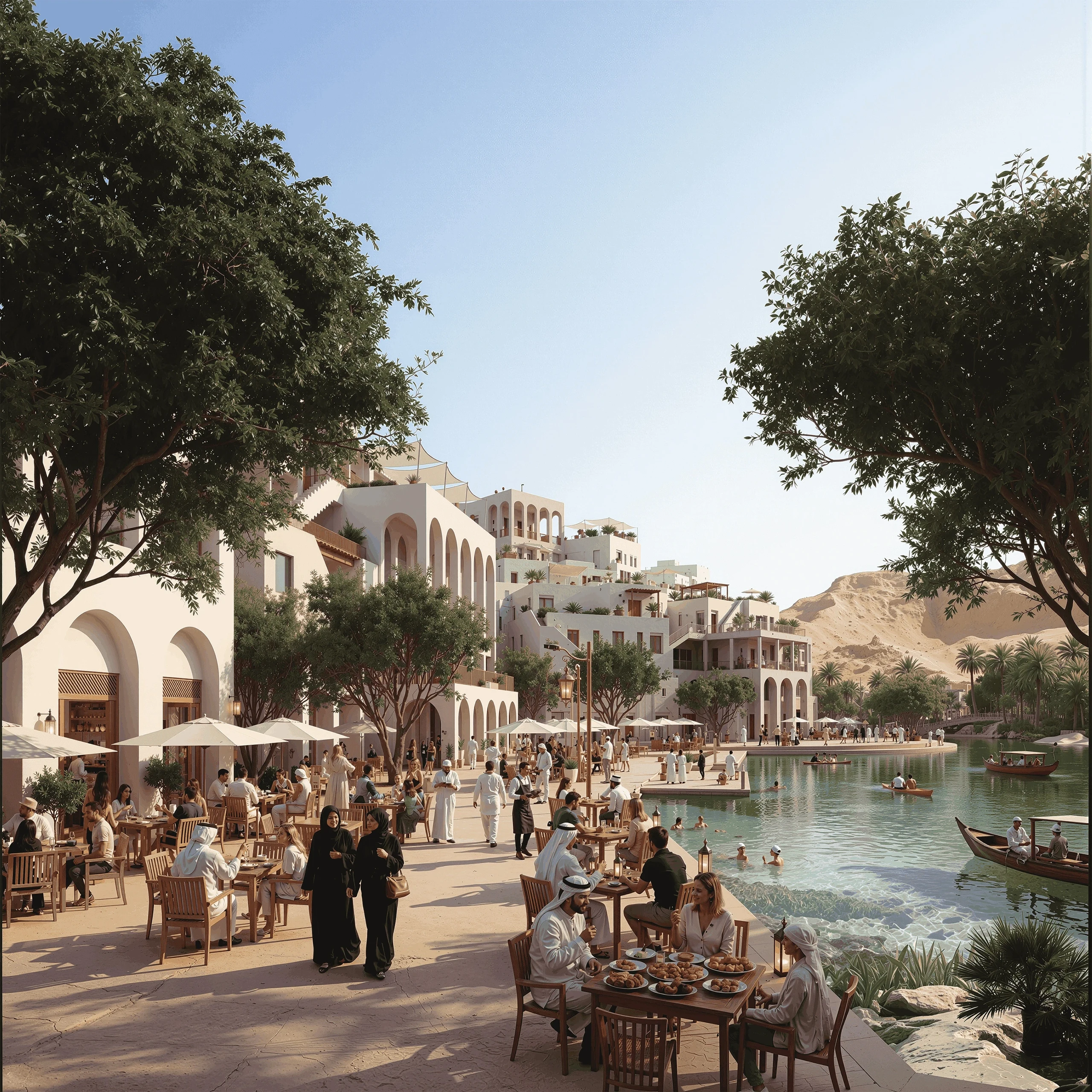
Lakeside Village concentrates housing, hospitality and public space around a defined water edge. Compact blocks and pedestrian routes connect the settlement to terraces, gardens and waterfront activity, creating a clear centre within the wider landscape and strengthening everyday life.
- Project and location
- A'Thuraya City, Muscat, Oman
- Year
- 2025
- Typology
- Masterplanning & Urbanism
05. Cliff Edfe Village
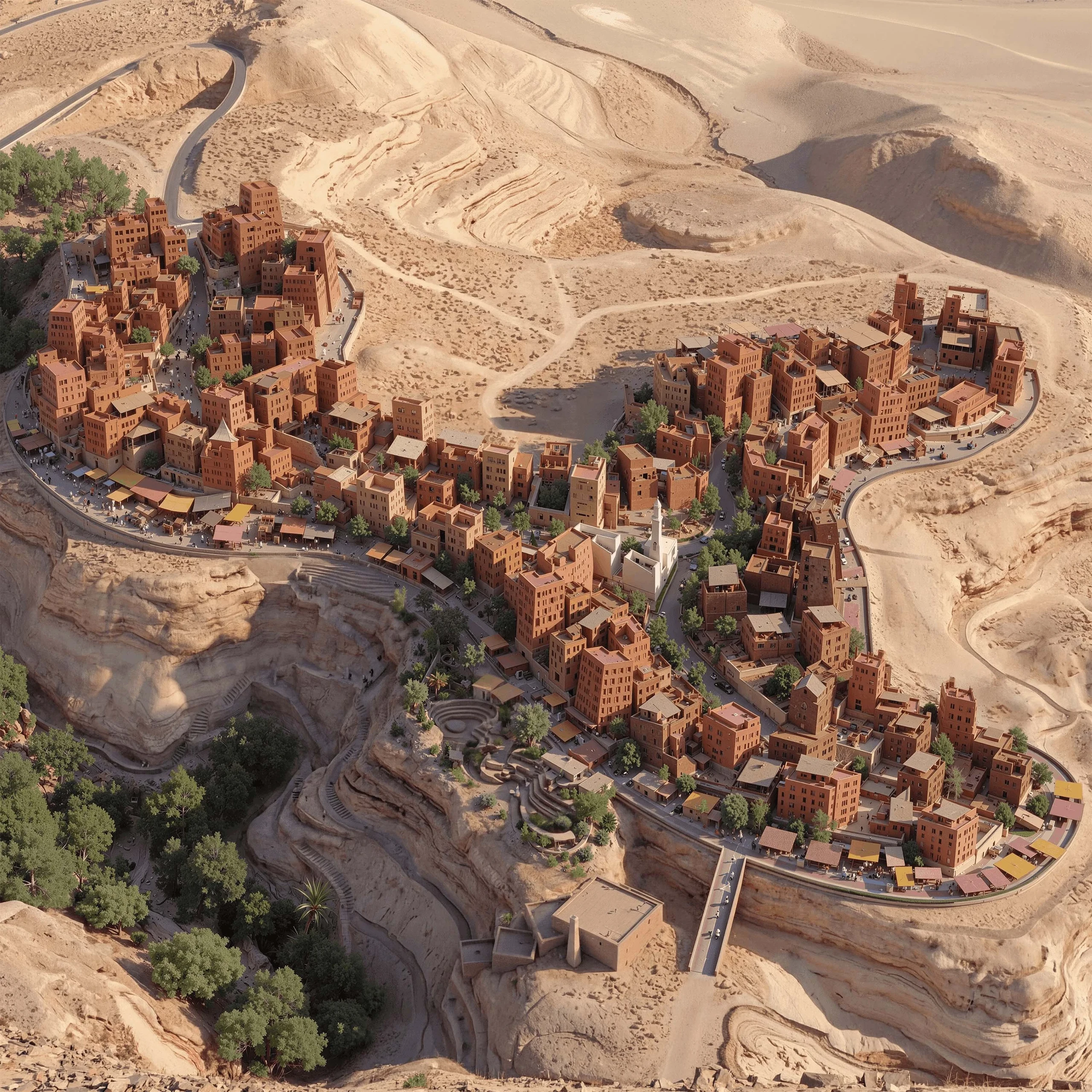
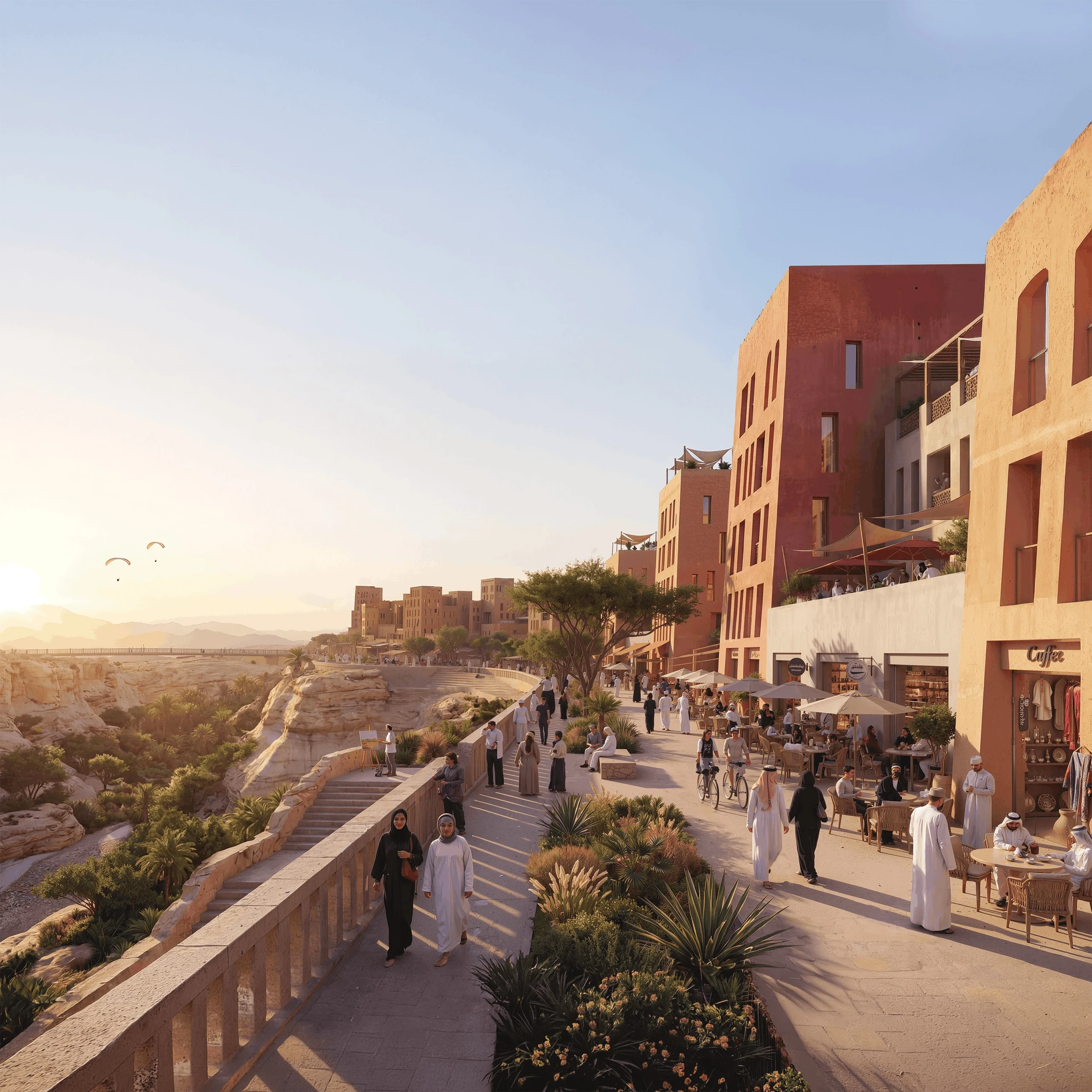
Cliff Edge Villas form a linear settlement along elevated terrain, using terraces, streets and public spaces to align development with the landform. The arrangement prioritises long-distance views while maintaining a compact urban grain and a clear relationship between the inhabited edge and the territory beyond.
- Project and location
- A'Thuraya City, Muscat, Oman
- Year
- 2025
- Typology
- Masterplanning & Urbanism
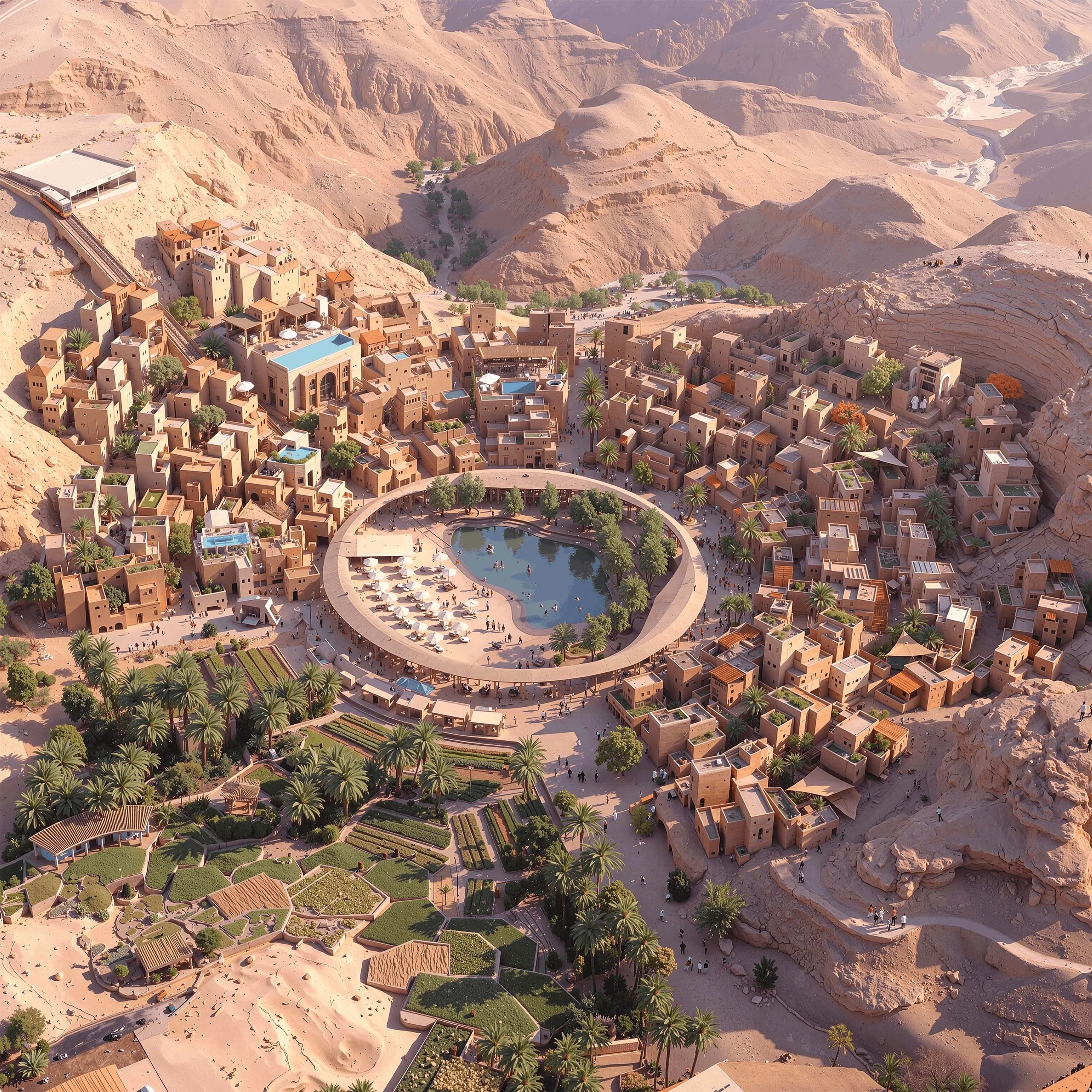
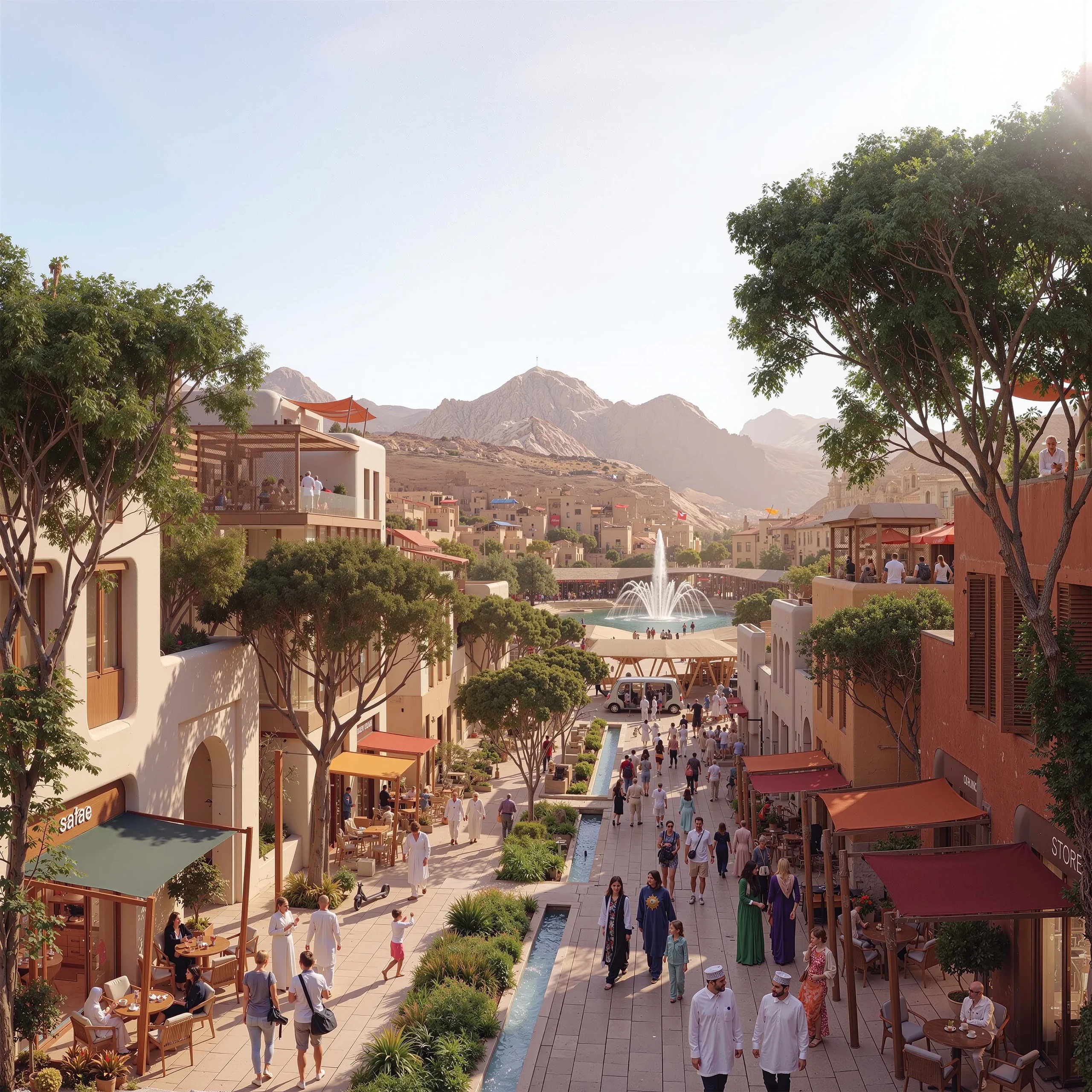
06. Amphitheatre Village
Amphitheatre Village occupies a naturally enclosed basin, organising homes and public programmes around a shared central landscape. The settlement steps with the terrain to create a legible centre, sheltered public spaces and short connections between residential clusters, agriculture and water.
- Project and location
- A'Thuraya City, Muscat, Oman
- Year
- 2025
- Typology
- Masterplanning & Urbanism
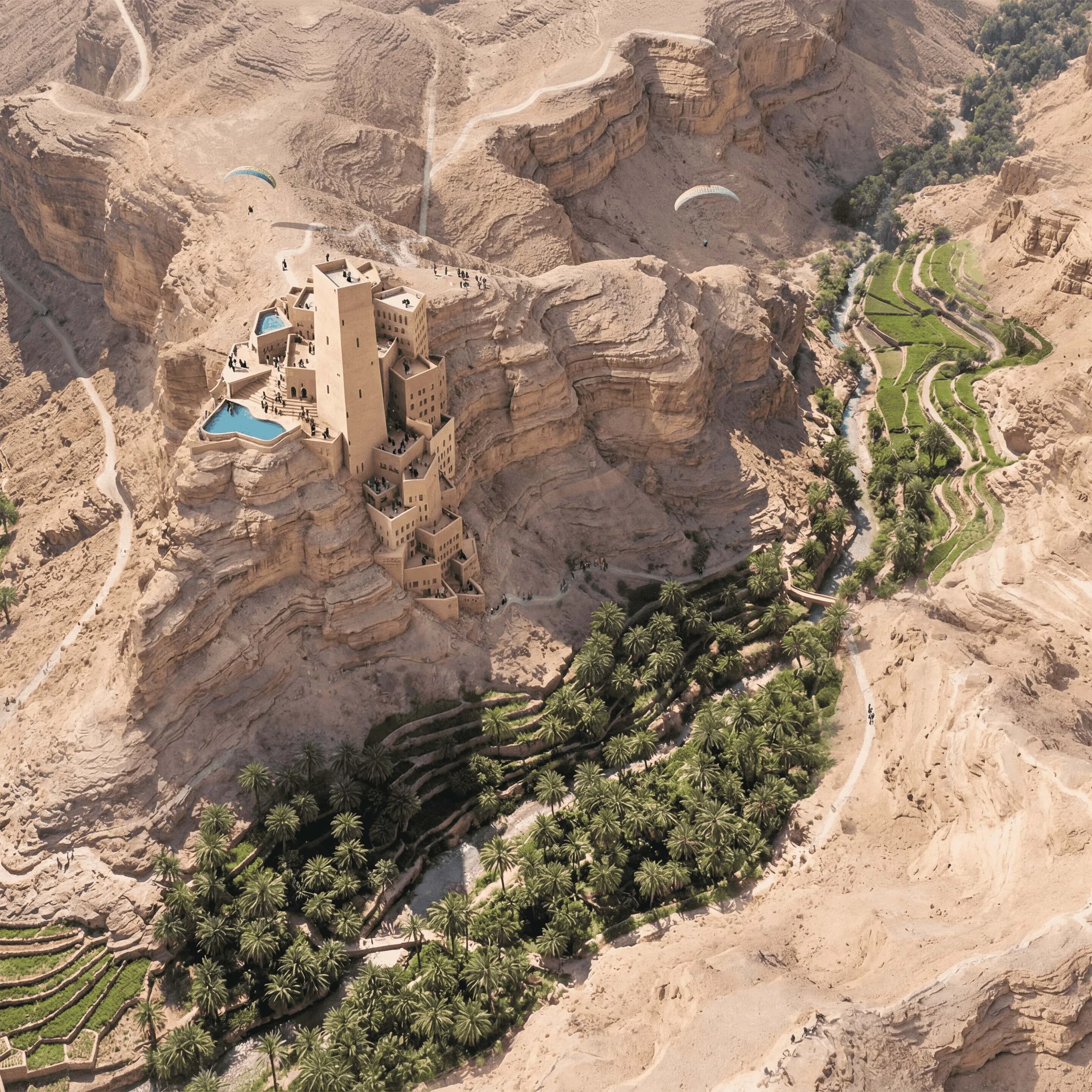
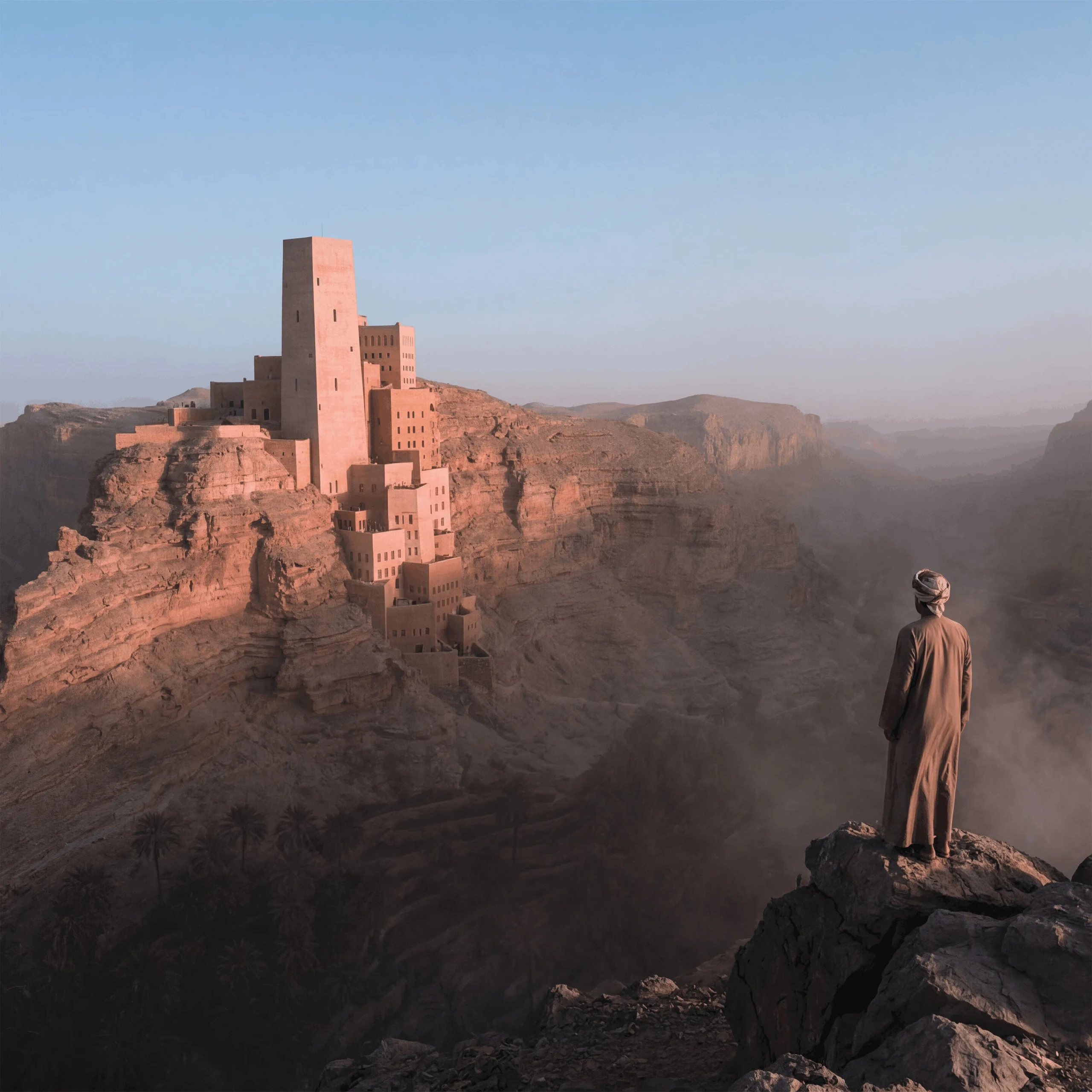
07. The Sky Castle
The Sky Castle occupies the site’s most visible rock formation as a concentrated civic and cultural landmark. Rather than extending dense urban fabric onto the peak, the proposal limits occupation and uses the vertical form to establish orientation across the wider masterplan, without dominating the landscape.
- Project and location
- A'Thuraya City, Muscat, Oman
- Year
- 2025
- Typology
- Masterplanning & Urbanism